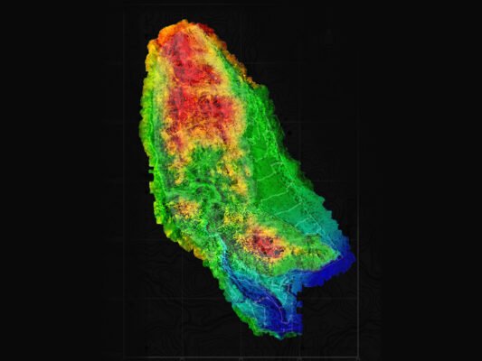
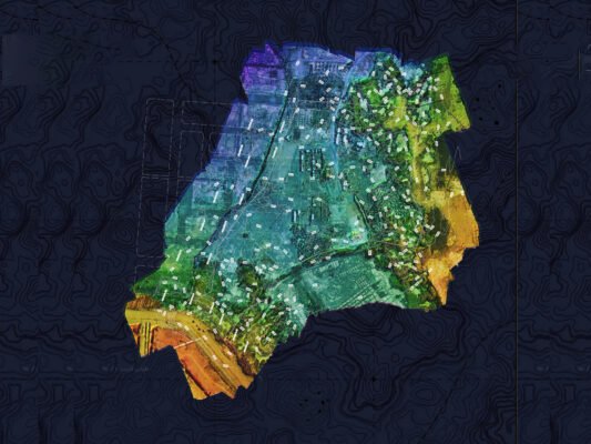
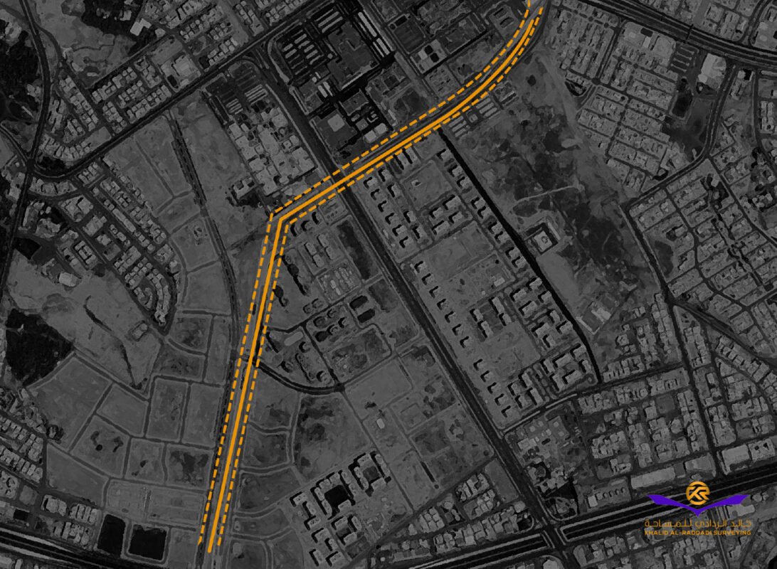
Municipality of Medina Project 2301
Project Location:
Medina, Saudi Arabia
Project Description:
Survey of 2 km long for landscape design
Project Area:
1,200,000/m
Primary Services:
Detailed Topographic Survey with Orthomosiac & DTM Raster with accuracy of less than 1 cm, Contouring, Mapping & Medelling
Client:
Municipality of Medina
Completed Projects: Precision in Topographic Survey, Orthomosaic & DTM, Mapping & Modelling Services
We have successfully delivered Detailed Topographic Survey, Orthomosaic & Digital Terrain Model (DTM) Services, Mapping, and 3D Modelling to a diverse range of clients, ensuring high-accuracy geospatial data for infrastructure development, land planning, and engineering projects. Our expertise in aerial and ground-based surveying provides comprehensive terrain analysis, precise mapping, and realistic 3D models for informed decision-making and project execution.
1. Detailed Topographic Survey
Our topographic surveys provide high-resolution elevation data, terrain mapping, and feature identification for various applications, including:
- Engineering and construction planning
- Land development and feasibility studies
- Infrastructure and utility mapping
- Environmental assessments and flood modeling
Using advanced survey equipment and aerial photogrammetry, we ensure accurate and reliable topographic data to support project success.
2. Orthomosaic & Digital Terrain Model (DTM) Services
We leverage drone and aerial imaging to generate high-resolution orthomosaic maps and DTM models, providing:
- True-to-scale, distortion-free imagery for land assessment
- Accurate terrain surface models for elevation and slope analysis
- Enhanced visualization and project planning
- Integration with GIS and CAD platforms for seamless design implementation
3. Mapping & 3D Modelling
Our mapping and 3D modeling services transform geospatial data into detailed, interactive visualizations, allowing clients to:
- Analyze terrain and structures with high precision
- Improve project planning and risk assessment
- Optimize construction workflows with digital site representations
- Utilize geospatial insights for smart infrastructure development
Delivering Accuracy & Innovation
By integrating cutting-edge technology, industry expertise, and a client-focused approach, we provide reliable geospatial solutions that drive efficiency and precision in every project. Our detailed topographic survey, orthomosaic & DTM, and 3D mapping services have been instrumental in industries such as real estate, construction, environmental management, and infrastructure development.
With our commitment to high-precision data and innovative geospatial solutions, we continue to support our clients in building a smarter, more sustainable future.