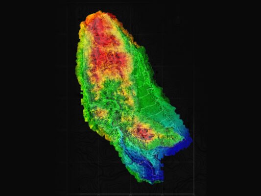
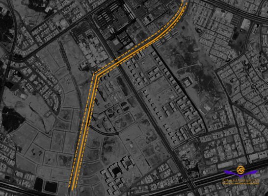
ACWA Power Project 2402
Project Location:
Haden , Saudi Arabia
Project Description:
Detailed Topographic Surveys for 70 km2 site area
Project Duration:
2 Weeks
Primary Services:
Establishment of geodetic control points network, Detailed Topographical survey, Aerial Survey
Client:
ACWA Power
Completed Projects: Geodetic Control Network & Detailed Topographic Survey Services
We have successfully delivered Geodetic Control Points Network Establishment and Detailed Topographic Survey Services to a diverse range of clients, ensuring high-precision geospatial data for surveying, mapping, and infrastructure projects. Our expertise in establishing accurate reference networks and capturing detailed terrain information has been instrumental in supporting engineering, land development, and construction initiatives.

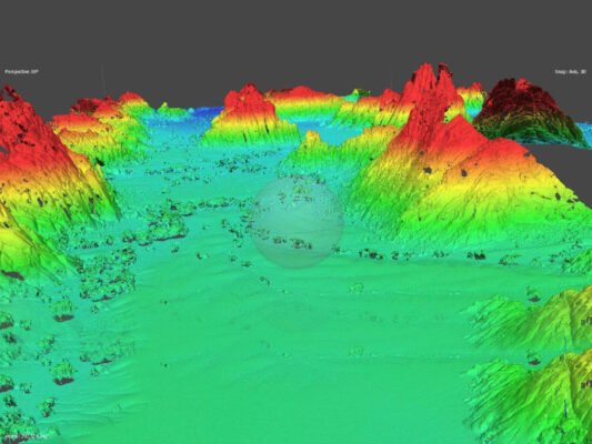
1. Geodetic Control Points Network Establishment
Our team specializes in setting up high-accuracy geodetic control networks, providing essential reference points for precise surveying and mapping. Using GNSS technology, total stations, and precise leveling techniques, we establish a stable geodetic framework that supports:
- Large-scale land and infrastructure projects
- Engineering design and construction planning
- National and regional geospatial reference systems
- Integration with global positioning frameworks (e.g., WGS84, UTM, or local coordinate systems)
We also offer network densification, verification, and maintenance services to enhance control point accuracy and reliability over time.
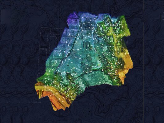
2. Detailed Topographic Survey
Our topographic survey services provide comprehensive terrain mapping, elevation data, and feature identification to support planning and development projects. Using advanced survey equipment and aerial photogrammetry, we generate:
- High-resolution contour maps for engineering and construction
- 3D terrain models for site planning and design
- Utility and infrastructure mapping for precise project execution
- Environmental and land-use analysis for informed decision-making
Precision, Reliability & Project Success
With a commitment to accuracy, efficiency, and client-focused solutions, our geodetic control network and topographic survey services have played a crucial role in infrastructure development, real estate planning, environmental studies, and government projects.
By leveraging state-of-the-art technology and industry expertise, we continue to provide high-precision geospatial data that empowers our clients to make informed decisions and execute projects with confidence.